


Derechos common in Iowa experts say
While Iowa has seen a recent uptick in the number of derechos, the weather events aren’t that different from usual.
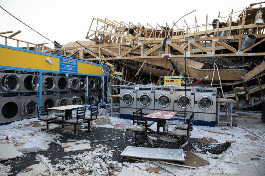
The remains of a laundromat is seen on Aug. 14, 2020. A derecho tore through Cedar Rapids on Aug. 10, causing destruction to buildings and homes throughout the state.
July 14, 2022
Iowa experienced its fourth derecho in under two years earlier this month, leaving Iowans wondering why the state has been hit by so many. The truth is, derechos have always been common in Iowa, experts say.
Chad Hahn, National Weather Service warning coordination meteorologist in Des Moines, said derechos have historically hit Iowa once every one to two years on average.
Hahn said moisture coming up from the Gulf of Mexico, combined with heat, strong winds and wind shear, create conditions in which derechos are able to thrive.
Hahn said another variable involved in the formation of derechos is climate change. He said while it would be incorrect to say climate change is the single cause of a derecho event, climate change can help to create more favorable conditions for a derecho to form.
While derechos may be common, most do not reach the level of the Aug. 2020 derecho event, in which winds reached speeds over 130 miles per hour.
“The July 5 event probably is more typical of what we would see in a given year,” Hahn said.
The July 5 derecho started in Montana and South Dakota, and moved across Iowa as the day went on, hitting several of the state’s biggest cities in its path. As opposed to the Aug. 2020 event, most of the July 5 event’s wind gusts traveled between 60 and 80 miles per hour, comparable to the derecho events from Dec. 2021 and May 2022.
Peter Speck, meteorologist for the National Weather Service in the Quad Cities, said June, July, and August are Iowa’s primary derecho months, because that’s usually when the jet stream from the Pacific is pointed at the state.
Part of what makes derechos common in Iowa, Speck said, are the high pressure systems in the western part of the country. Speck said these systems — common in the summer — help to create progressive derechos, the kind of derecho that hit the state on July 5 and in Aug. 2020.
“In essence, storms just ride over that high pressure and continue [in an] eastward or southeastward motion,” Speck said. “… They take advantage of the very strong instability and very high temperatures ahead of it.”
Now, the jet stream is shifting to the north toward the Great Lakes. Speck said because of this, he doesn’t expect weather patterns to be as active as they were earlier in the year.
While Speck doesn’t expect derechos to hit Iowa in the near future, he said forecasting is always prone to change. Even a minor disturbance can throw the jet stream off and cause it to change positions.
“I believe it was two years ago we expected below normal temperatures for a month and then the jet stream got shifted northward into our area,” Speck said, “We got active winter weather, but also we got warmer temperatures to coincide with that.”
Speck said people should be assured that not all derechos are created equal, as they vary in strength and size. However, he said, in the case of extreme weather events people should stay tuned to the latest forecast information, keep themselves prepared, and have a plan in place.